HydroBoat 1200MB
Gallery
Overview
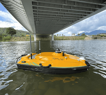
The HydroBoat 1200MB is SatLab's latest USV multibeam solution, integrating proven unmanned vessel technology with the HydroBeam M2 MBES. It is designed for precise multibeam mapping, achieving high accuracy in narrow and obstacle-dense waterways.
HydroBoat 1200MB is a civilian USV platform developed by SatLab Geosolutions in Sweden. The HydroBoat 1200MB is SatLab's latest USV multibeam solution, integrating proven unmanned vessel technology with the HydroBeam M2 MBES. It is designed for precise multibeam mapping, achieving high accuracy in narrow and obstacle-dense waterways. It is positioned for multibeam hydrographic surveying and bathymetryand is listed publicly as active. Published specifications captured in this database include a published length of about 1.2 m, reported endurance of ~3 h, reported speed of Max speed 4 m/s, and payload information listed as HydroBeam M2 multibeam echo sounder. The platform is described as autonomous / remote in terms of control and autonomy. Its concept emphasizes persistent on-water presence, modular payload integration, and lower operating burden than a comparable crewed craft. Additional context: The HydroBoat 1200MB has been used for precise mapping in Japan's Yodo River, achieving IHO Special Order accuracy.
Primary Roles
Notes
The HydroBoat 1200MB has been used for precise mapping in Japan's Yodo River, achieving IHO Special Order accuracy.